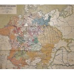
Wandkarte zur Deutschen Geschichte des 16. Jahrhunderts (Large Pull Down Map)
Click Image for Gallery
Wandkarte zur Deutschen Geschichte des 16. Jahrhunderts (Large Pull Down Map)
Alfred Baldamus, Eduard Gaebler, Otto Berthold, Max Fehle
Klasing Lang, Leipzig, Leipzig, 1939
[Early Modern Germany] 170 x 197 cm. Mounted on muslin, wood rods top and bottom. Top wooden rod is broken. Significant chips, cracks, tears. Bottom taped. See photos! Scale 1:800 000. Sammlung historischer Schulwandkarten, Abt. 3, No 1. Note: This is a large, heavy map. Additional postage will apply depending on delivery location.


