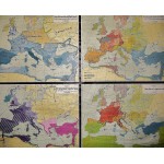
Vom Romischen Weltreich zum Karolingerreich : (Large Pull Down Map of Europe)
Click Image for Gallery
Vom Romischen Weltreich zum Karolingerreich : (Large Pull Down Map of Europe)
A. Koselleck
Flemmings Verlag, Hamburg, 1950
[The Carolingian Empire] Large pull down color map fitted with wood rods for wall mounting. 167 x 204 cm. 1:4,500,000. Includes 4 color maps, on muslin; 75 x 96 cm. Contents: 1. Das Romische Weltreich mit den Grenzen seiner grossten Ausdehnung; 2. Auflosung des Romischen Reiches durch die Volkerwanderungen; 3. Christianisierung Europas bis ins 9. Jahrh; 4. Das Karolingerreich
Note: This is a large, heavy map. Additional postage will apply depending on delivery location.


