United States, including territories and insular possessions : showing the extent of public surveys, national parks, national forests, Indian reservations, national wildlife refuges, and reclamation projects (Large Pull Down Map)
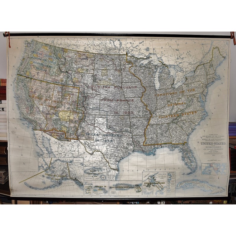
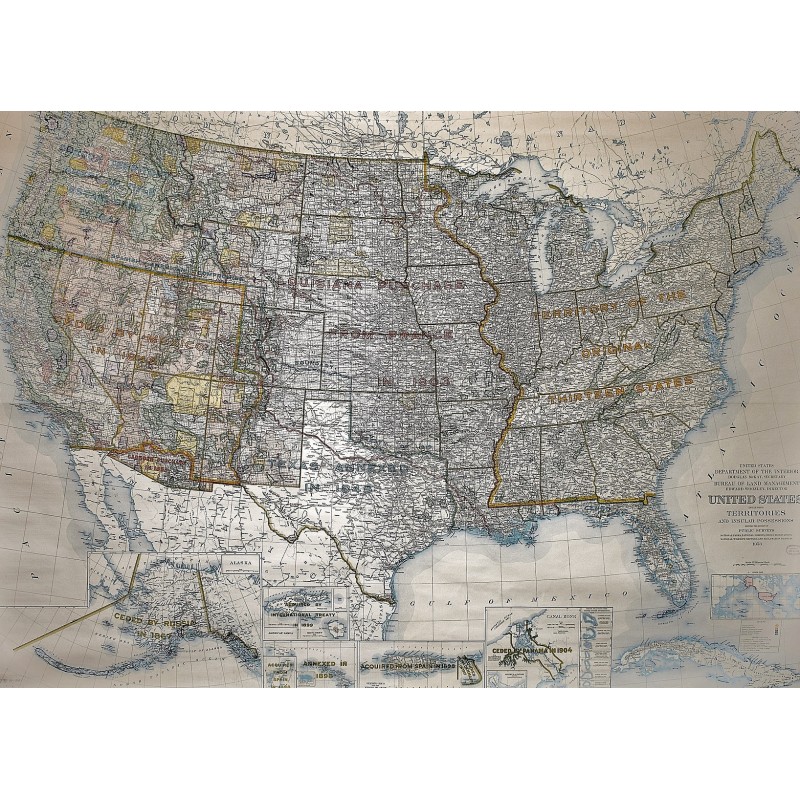
United States, including territories and insular possessions : showing the extent of public surveys, national parks, national forests, Indian reservations, national wildlife refuges, and reclamation projects (Large Pull Down Map)
INTERIOR GEOLOGICAL SURVEY, BARTLE, R.F. & CO.
Dept. of the Interior, Washington, D.C., 1953
[Territorial Growth Map of the United States with dates and boundaries.] 150 x 210 cm. (59.30 H x 82.00 W Inches) Color map mounted on muslin, wood rods top and bottom. Institutional stamp by title. Small crease at top. In addition to information listed in the title, shows territorial growth with dates of acquisition to the "Territory of the thirteen original states." Insets: Alaska -- American Samoa -- Guam or Cuajan Island -- Hawaiian Islands -- Puerto Rico and the Virgin Islands of the U.S. -- Canal Zone -- Pacific Islands under United States sovereignty -- Index map. Relief shown by hachures and spot heights. Scale [ca. 1:2,344,320] 37 miles to 1 in., (W 125--W 65/N 49--N 19). Note: This is a large, heavy map. Additional postage will apply depending on delivery location