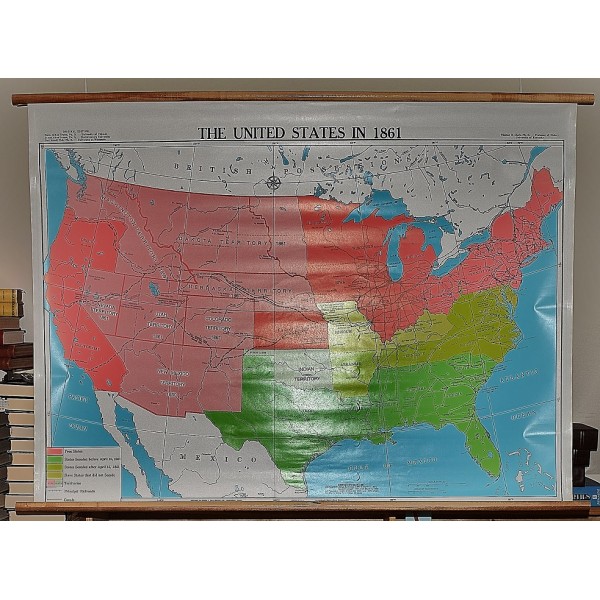
The United States in 1861 (Large Pull Down Map)
Click Image for Gallery
The United States in 1861 (Large Pull Down Map)
George F. Cram Company (Cartographer, Issuing body), Thomas Dionysius Clark (Editor)
George F. Cram Company, Indianapolis, 2001
[Civil War Political Map of the United States] 89 x 127 cm. Mounted on wood rods, top and bottom. Note: This is a large, heavy map. Additional postage will apply depending on delivery location.

