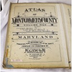
Property Atlas of Montgomery County, Maryland (2 volumes, 1948-1949)
Property Atlas of Montgomery County, Maryland (2 volumes, 1948-1949)
Frank H. M. Klinge
Frank H. M. Klinge, 1948
[Rare Property Atlas of Montgomery County.] 2 volumes. Atlas folios, 23 x 18 inches (58 x 45 cm.) Bound in publisher's cloth. Shelf, cover wear. Moderate dampstaining to v.2. Index page of v.1 is torn with substantial loss.
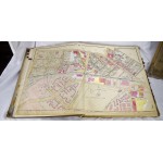
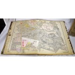
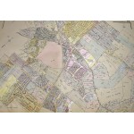
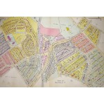
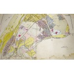
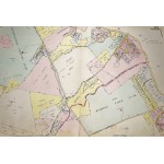
Maps are 36" (89 cm) wide, double page. Hand colored, showing rivers, roads, parks, railroads, residences with buildings, owner's names and lot sizes, government buildings, etc. Vol. 1, List of Maps: 1. Montgomery County outline, showing the Potomac to the city of Washington to Prince George's County, bound by Bladensburg, Viers Mill, Bradley Blvd.; 2. Tacoma Park, Eastern Ave., Pine Crest, M.C./P.G. County line.; 3. Tacoma Park, Eastern Ave, Pine Branch; 4. Eastern Ave., East West Highway, Woodside, Silver Spring, Georgia Ave.; 5. Woodside Forest Glen, Seminary Rd.; 6. Woodside Park, Georgia Ave. Sligo Branch; 7. Silver Spring; 8. Silver Spring, Piney Branch, Sligo Creek Parkway, Tacoma Park; 9. University Ave., Piney Branch, Silver Spring; 10. Sligo Creek, Long Branch, East Silver Spring High School; 11. North Tacoma Park, Silver Spring; 12. Forest Glen, Sligo Parkway; 13. Capital View, Seminary Rd., Homewood; 14. Kensington; 15. Kensington Heights, Georgia Ave., Glen View; 16. Viers Mill; 17. Twinbrook, Rock Creek, Aspen Hill; 18. Viers Mill; 19. Rock Creek, Avery Rd.; 20. Wheaton, Georgia Ave., Glenmont, Layhill, Aspen Hill, Viers Mill; 21. Norbeck, Georgia Ave.; 22. Northwest Branch, Colesville; 23. Colesville, Columbia Pike; 24. Colesville; Northwest Branch; 25. Burtonsville, Beltsville Rd., Spencerville; 26. Burtonsville to Howard County, Patuxent River; 27. Brown’s Corner, Ednor; 28. Sandy Spring, Olney, Norwood, Ashton; 29. Norwood Rd., Layhill. <br> Vol. 2: List of Maps: 1. Montgomery County outline, showing the Potomac to the city of Washington to Prince George's County, bound by Bladensburg, Viers Mill, Bradley Blvd.; 2. Chevy Chase Country Club, Chevy Chase section 1, section 2, to Western Ave. line, D.C.; 3. Chevy Chase Country Club, bound by Connecticut Ave; 4. Chevy Chase; 5. Chevy Chase, Columbia Country Club, Connecticut Ave; 6. Chevy Chase; Bethesda Chevy-Chase High School, East West Highway 7. Chevy Chase, Bradley Rd., Wisconsin Ave; 8. Edgemoor, Bradley Hills; 9. Woodmont Country Club, Wisconsin Ave. Westborough; 10. Edgemoor, Bradley Hills, Battery Park, Old Georgetown Rd.; 11. Friendship Heights, Summerset Heights, Little Falls Parkway; 12. River Rd., Military Rd., Massachusetts Ave. Little Falls Branch; 13. Potomac River, River Road, Glen Echo, Brookmont, C & O Canal, Little Falls; 14. Potomac, Glen Echo, Kenwood Golf Club; 15. Potomac, Cabin John; 16. Bradley Hills, Landon School, Georgetown Ave.; 17. Rock Creek Park, Rockville Pike, Georgetown Prep; 18. Rock Creek Park, North Chevy Chase Elementary School, U.S. Naval Medical Center, Chevy Chase; 19. Rock Creek Park, Walter Reed, Chevy Chase, East West Highway; 20. Walter Reed Hospital, Rock Creek Park, Kensington Park; 21. Kensington, Kensington View, Bladensburg Rock Creek Park; 22. Rock Creek Park, Garrett Park; 23. Congressional Country Club, Seven Locks, Bradley Blvd; 24. Bethesdam, Tusculum, Bethesda Country Club, Bradley Blvd, Old Georgetown Rd.; 25. Carderock, Macarthur Blvd, George Washington Memorial Park, C & O Canal, Great Falls, Potomac; 26. Potomac, Great Falls, C & O Canal, Macarthur Blvd., Falls Rd. 27. Potomac, Cranford Corner, Seven Locks; 28. Montrose, Rockville Pike, Rockville; 29. Falls Rd., Downtown Rockville, Rockville Pike, Dawson’s Creek, Seven Locks; 30. Boswell’s Glen, Potomac River, Travilah; 31. Town of Rockville (District 4), Richard Montgomery High School.


