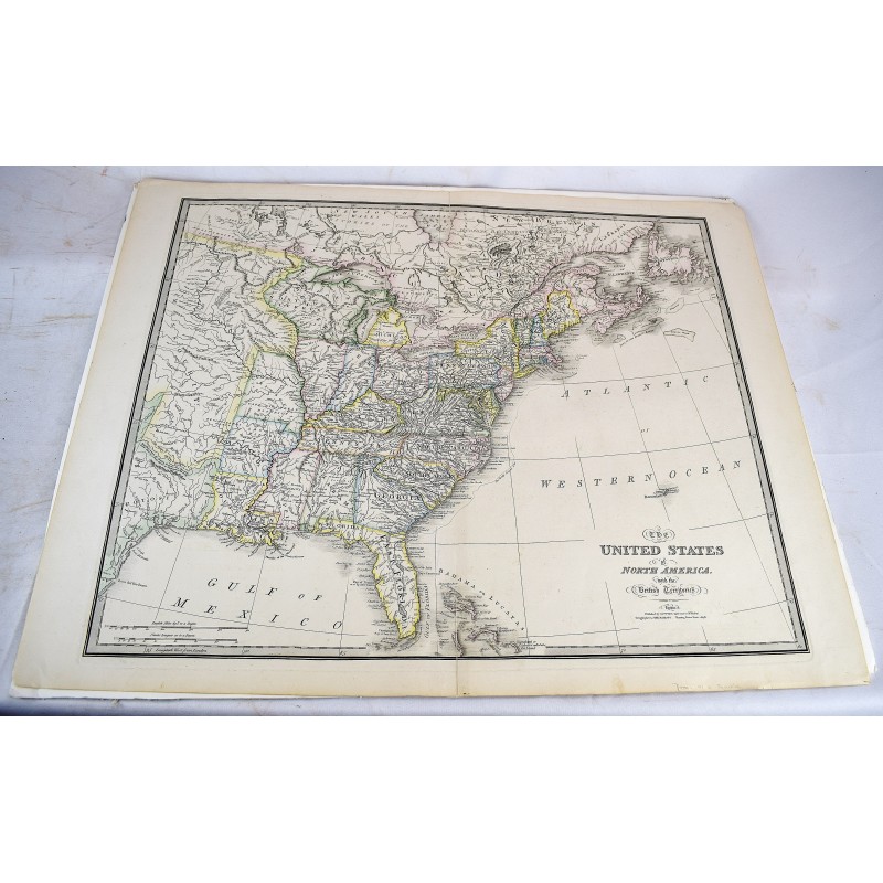
The United States of North America, with the British Territories
Click Image for Gallery
The United States of North America, with the British Territories
James Wyld; William Faden
Jas. Wyld (successor to Mr. Faden), geographer to his majesty, Charing Cross East, 1832
74.2 x 59.5 cm. 23 x 29 inches (including margins). Outlined in color. 2 small closed tears along fold. Ref: Stevens and Tree, Comparative cartography, 1838(l) (Tooley, p. 101). Shows Texas a republic. This issue introduces the states of Missouri and Arkansas. For a comparison of the Faden/Wyld maps, see: Henry Stevens and Roland Tree, "Comparative cartography" (Chapter 2, Mapping of America / R.V. Tooley, p. 100-101.)