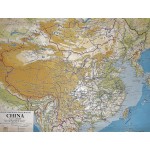
Philip's Regional Wall Map of China (Large Pull Down Map)
Click Image for Gallery
Philip's Regional Wall Map of China (Large Pull Down Map)
George Philip & Son
George Philip & Son, London, 1963
83 x 119 cm. Mounted on muslin, wood rods top and bottom. Relief shown by gradient tints, form lines, and spot heights. Scale 1:5,000,000 ;, Bonne projection, (E 70--E 140/N 50--N 20).
Note: This is a large, heavy map. Additional postage will apply depending on delivery location.


