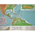
Mexico, Central America, West Indies and Northern South America (Large Pull Down Map)
Click Image for Gallery
Mexico, Central America, West Indies and Northern South America (Large Pull Down Map)
Denoyer-Geppert Company, Clarence Fielden Jones
Denoyer-Geppert Co., Chicago, 1961
107 x 136 cm. Mounted on muslin and fitted with rods. Light fray at top left corner where map connects to wooden rod. Relief shown by shading, gradient tints and spot heights. Insets: Puerto Rico -- Panama Canal ZoneEnglish and Spanish. Denoyer-Geppert visual-relief series, Map S567vr. Scale 1:7,200,000.
Note: This is a large, heavy map. Additional postage will apply depending on delivery location


