Map Of The United States, Mexico, Oregon, Texas, The Californias (1846)
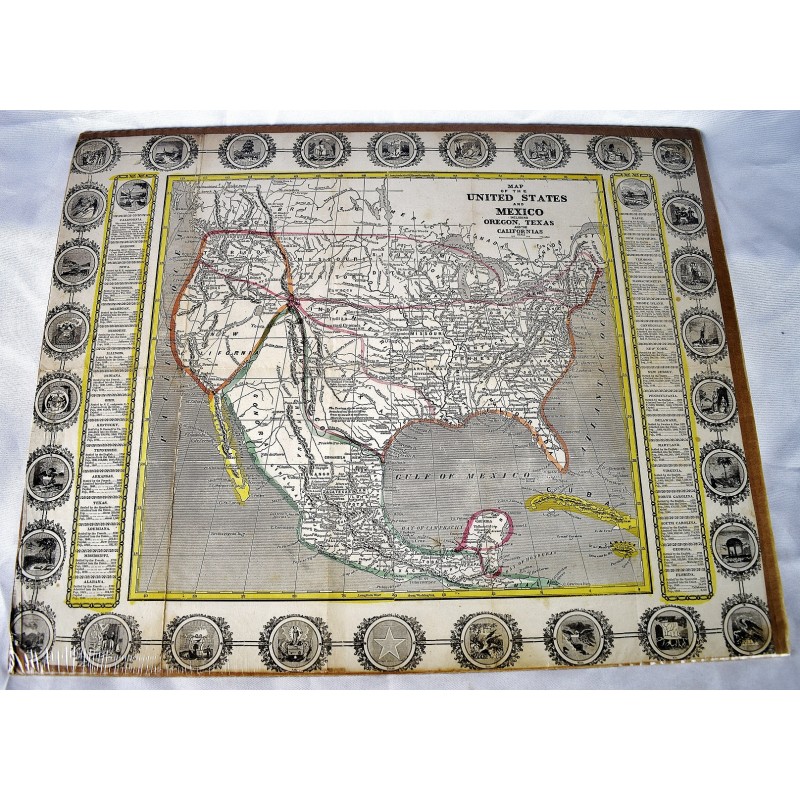
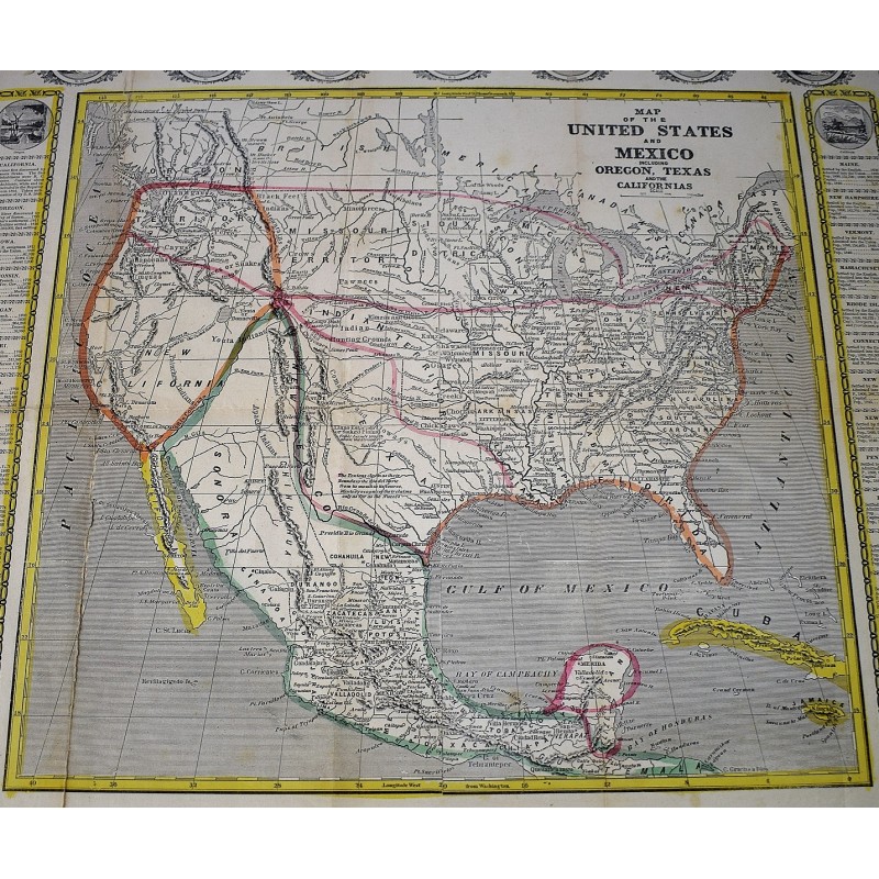
Map Of The United States, Mexico, Oregon, Texas, The Californias (1846)
John Haven
1846
[Mexican-American War Era Map] Broadside proclaiming Manifest Destiny published at the outset of the Mexican American War. Woodcut map with hand-colored outline. 46 x 56.5 cm. (18 x 22-1/4 inches). Closed tear on left side along fold. Bottom left corner slightly chipped affecting seal of Ohio. Margins trimmed close to state seals. From the map: "The Texians claim as their Boundary the Rio del Norte from its mouth to its source, Mexico recognizes their claims only as far as the Nueces." The coloring draws the border to the Rio Grande. Other interesting points: Comanches and Kioways territory; Nauvoo, Illinois (Mormon refuge); and a Northern "Boundary as Claimed by the United States," and a "Boundary as offered by compromise by the United States," showing claim to Oregon territory. <br> John Haven attribution, according to David Rumsey: "Wheat says Haven, 1846. This copy was published late in 1846. Streeter 3871 attributes this to Ensign and Thayer due to its similarity to their 1848 Ornamental Map of the U.S. and Mexico (Streeter 3872). Wheat says that this map is the source of Haven's broadside map of 1846 (Wheat 26) and the Journal of Commerce map of 1848 (Wheat 47), which use the top 2/3 and bottom 2/3 respectively, of this map, and therefore Wheat attributes this to Haven. The 1846 date is the latest date in the statistics on the states that flank the map. Wheat mentions that he found a copy in Farnham's Life and Travels in California, and our copy has written on the back in ms "Life and Travels in California," so this may be another place it was used, or what it was originally made for. Includes "panoramic view of Oregon and California, and state seals. Relief shown by hachures. Prime meridians are Greenwich and Washington, D.C." - David Rumsey Historical Map Collection, 2575. Wheat, Maps of the California Gold Region 38 (slightly different issue): "A flamboyant affair. Haven, 'Suter's Colony' is given prominence in 'New California,' but no hint of the gold discoveries on either the map or the broadside that surrounds it."
Refs: Wheat 513; cf Wheat Gold 26; High Ridge 15; Streeter 3871. "A crude and most interesting piece, with curious boundaries: 'New California' extends east to the 109th degree, and Oregon north to Alaska!" - Eberstadt 136:122