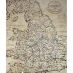
Laurie & Whittle's New Map of the Inland Navigation of England & Wales, with That of Scotland, to the South of Edinburgh and Glasgow
Click Image for Gallery
Laurie & Whittle's New Map of the Inland Navigation of England & Wales, with That of Scotland, to the South of Edinburgh and Glasgow
Nathaniel Coltman; Lawrie & Whittle.
London, R. Laurie & J. Whittle, 1808
Large map of the United Kingdom, under glass in frame. 757 x 598 mm; 29-1/2 x 23-3/4 inches. Counties outlined in color. 14 miles to an inch. Trimmed at bottom, with some wear (perhaps loss to tip of Cornwall? I didn't take it out of the glass.) Thematic map of the rivers, canals and railroads of England. This is an oversized map which requires additional postage for international delivery outside the US.


