Histoire Philosophique Et Politique Des Etablissemens Et Du Commerce Des Europeens Dans Les Deux Indes. 5 Vols: 4 Text + Atlas
Histoire Philosophique Et Politique Des Etablissemens Et Du Commerce Des Europeens Dans Les Deux Indes. 5 Vols: 4 Text + Atlas
Guillaume-Thomas Raynal
Geneva: Jean-Leonard Pellet, 1780.
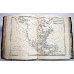
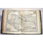
5 volumes. Jean-Leonard Pellet, 1780 printing. Contemporary full mottled calf, marbled edges and endpapers. 25 maps are of portions of North and South America and the Caribbean. A large part of the work is said to have been written by Diderot, and others. Taking a radical anti-imperialistic stance, the nineteen books that comprised the original work covered the history of European colonization of India, the East Indies, China, parts of Africa, and the Americas. Much of the success, and subsequent reputation, of the Histoire was based on its attacks on tyranny, slavery and colonial exploitation, and it quickly became one of the basic texts for the humanitarian movement. The book was condemned by the French parliament and church dignitaries, and Raynal was obliged to leave France. Bindings variously worn/robbed, few joints starting. Mostlylight toning throughout, occasional foxing and dampstain (usually marginal). Lacking tables. 49 double-page maps. Vol 1: xvi,741,[i] pp. 2 pencil notations to lowermargin of title. Vol 2: [4], viii,485,[i] pp. Vol 3: [xvi],629,[i]pp. Vol 4: [4], viii,770,[i]pp. Atlas: No formal title page, half title reads, "Atlas De Toutes Les PertiesConnues Du Globe Terrestre, Dresse Pour L'Histoire Philosophique Et Politique des Etablissemens et du Commcerce Des Europeens Dans Les Duex Indes." [4]28pp.49 double-page maps by Rigobert Bonne, several crediting Andre as engraver in margin at lower right. (Maps 1-2) World, in hemispheres and as Mercator projection. (3) Europe. (4) Asia. (5) Africa. (6-8) Mediterranean locales. (9-16) African & Asian regions. (17-22) European countries. (23) Philippines & southeast Asia. (24) Russian Empire, including Arctic coast, Kamchatka, Bering Strait, and part of northwestern North America. Reflecting the uncertainty about coastlines in northeastern Asia and northwestern North America, map No. 24 shows a group of islands, "Archipel du Nord," east of Kamchatka, south of the Bering Strait, and west of the Aleutian Islands' actual location. (25) North America, from Greenland to Colombia and the Caribbean. Shows Alaska as much narrower than its actual shape, with theisland group to its west. (26) Caribbean. (27-35) Central & South American locales. (36-41) Caribbean islands. (42-43) Northern Africa. (44) Eastern Canada. (45)Central Canada, from James Bay to modern-day American upper midwest, labeling dozens of tribes and rivers of the Mississippi basin. (47-48) United States. (49) 7maps of Caribbean islands.


