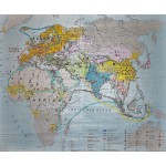
Handelzentren und Handelswege in der Alten Welt (14. und 15. Jahrhundert) (Large Pull Down Map)
Click Image for Gallery
Handelzentren und Handelswege in der Alten Welt (14. und 15. Jahrhundert) (Large Pull Down Map)
W. Stegner
Haack, Gotha, 1983
[Trade centers and trade routes in the Old World (14th and 15th centuries)] 150 x 120 cm. Mounted color map, wood rods top and bottom. Scale: 1:12.500.000. Note: This is a large, heavy map. Additional postage will apply depending on delivery location.


