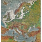
Europe: Wenschow Relief-Like Map (Large Pull Down Map)
Click Image for Gallery
Europe: Wenschow Relief-Like Map (Large Pull Down Map)
Karl Wenschow
Denoyer-Geppert (Chicago, Ill), 1962
160 x 175 cm. Also shows the pre-war 1937 boundaries. Mounted on muslin, wood rods top and bottom. Scale 1:6.000.000.. Map RL. 23. Lambert's azimuthal projection.
Note: This is a large, heavy map. Additional postage will apply depending on delivery location


