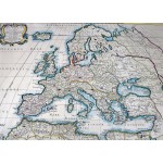
Europa Vetus ex Conatih. Geographicis N. Sanson Abbavillaei. Christianiss. Galhiar. Regis Geographi (Original, Colored Map, Framed Under Glass)
Click Image for Gallery
Europa Vetus ex Conatih. Geographicis N. Sanson Abbavillaei. Christianiss. Galhiar. Regis Geographi (Original, Colored Map, Framed Under Glass)
Nicholas Sanson; Pierre Mariette
Petrum Mariette: Lutetiae Parisiorum, 1650
[Ancient Europe : The Roman Empire] Fine hand-colored, double-page engraved map of Roman provinces of Europe. Mounted in wood frame, with wooden side handles. Dimensions of mounted image: 40 x 56 cm. (53 x 69.5 cm in frame). Latin province names, cities, seas. This is an oversized or heavy book, which requires additional postage for international delivery outside the US.


