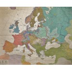
Europa im 16. Jahrhundert (Large Pull Down Map)
Click Image for Gallery
Europa im 16. Jahrhundert (Large Pull Down Map)
Gerhard Ziegler, Walter Heidenreuter (Author), Hermann Haack Geographisch-Kartographische Anstalt Gotha
Hermann Haack, Geographisch-Kartographische Anstalt, Gotha, 1963
[Early Modern Europe in the 16th century] 158 x 197 cm. Color map, mounted on muslin, wood rods top and bottom. Scale 1:3 000 000.
Note: This is a large, heavy map. Additional postage will apply depending on delivery location


