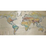
Die Landschaftsgurtel der Erde : Physical Map of the Earth (Large Pull Down Map)
Click Image for Gallery
Die Landschaftsgurtel der Erde : Physical Map of the Earth (Large Pull Down Map)
Hermann Haack Geographisch-Kartographische Anstalt Gotha, Konrad Olbricht, Fritz Haefke
Haack, Gotha, 1967
122 x 210 cm. Color map mounted on muslin, , wood rods top and bottom. Cartography by Olbricht and Haefke. Relief shown by contours, shading, gradient tints and spot heights. Depths shown by gradient tints and soundings. "VLN 1001 ... Nr.8/64/67-10/67-1000." Scale 1:20,000,000. Note: This is a large, heavy map. Additional postage will apply depending on delivery location


