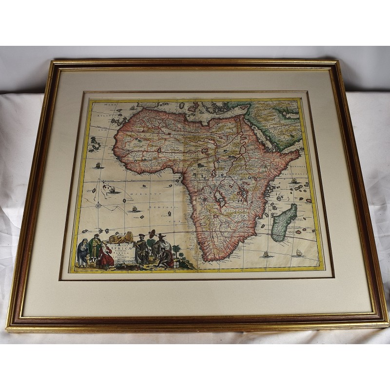
Totius Africae Accuratissima Tabula (17th Century Map of Africa)
Click Image for Gallery
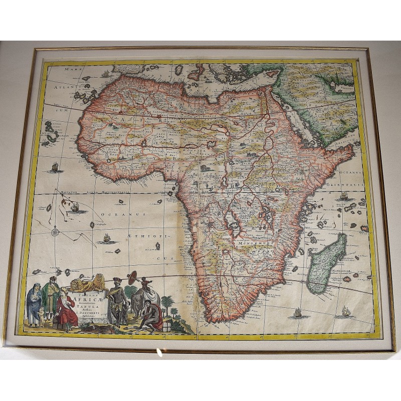
Totius Africae Accuratissima Tabula (17th Century Map of Africa)
Frederick de Wit; Justus Danckerts
Amsterdam; Danckerts, 1685
[An Early 17th Century Map of Africa, vividly colored] Map dimensions: 19.5 x 23 in; frame: 29 x 32 in. Copper engraved map of Africa with contemporary with contemporary hand coloring. Double-page engraved map of Africa, based on the work of Frederick De Wit. Small old ink stain in the Atlantic Ocean. The map features images of elephants, ostriches, monkeys, lions and rhinoceros. The title cartouche features Moors and Africans with a child seated on an elephant and two lions perched atop the cartouche. Rear back of map includes a letter with W. Graham Arader's description of the Danckert's map engravings. Circa 1685-1690.