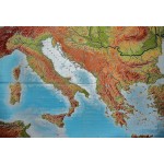
Apenninen- und Balkanhalbinsel (Large Pull Down Map)
Click Image for Gallery
Apenninen- und Balkanhalbinsel (Large Pull Down Map)
Hermann Haack, Werner Painke, Rudolf Moeller, Gerhardt Fischer
Perthes, Darmstadt, 2000
[Physical Map of Italy, the Apennines and Balkan Peninsula, Corsica, Sardinia, Greece, North Africa] 268 x 192 cm. Large wall map, with wooden rods, top and bottom. scale 1: 750 000.
Note: This is a large, heavy map. Additional postage will apply depending on delivery location.


