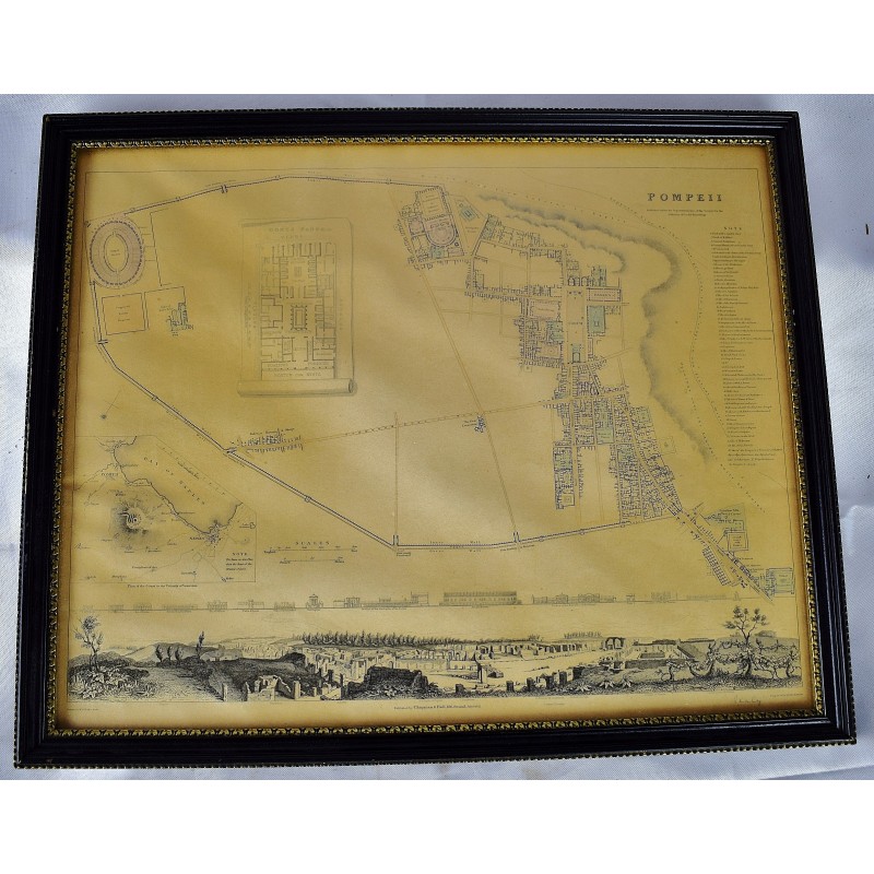
Pompeii. Published under the superintendence of the Society for the Diffusion of Useful Knowledge. Drawn by W.B. Clarke, arch. Engraved by T.E. Nicholson. Published by Baldwin & Cradock, 47 Paternoster Row, July 1, 1832. [Map framed under glass]
Click Image for Gallery
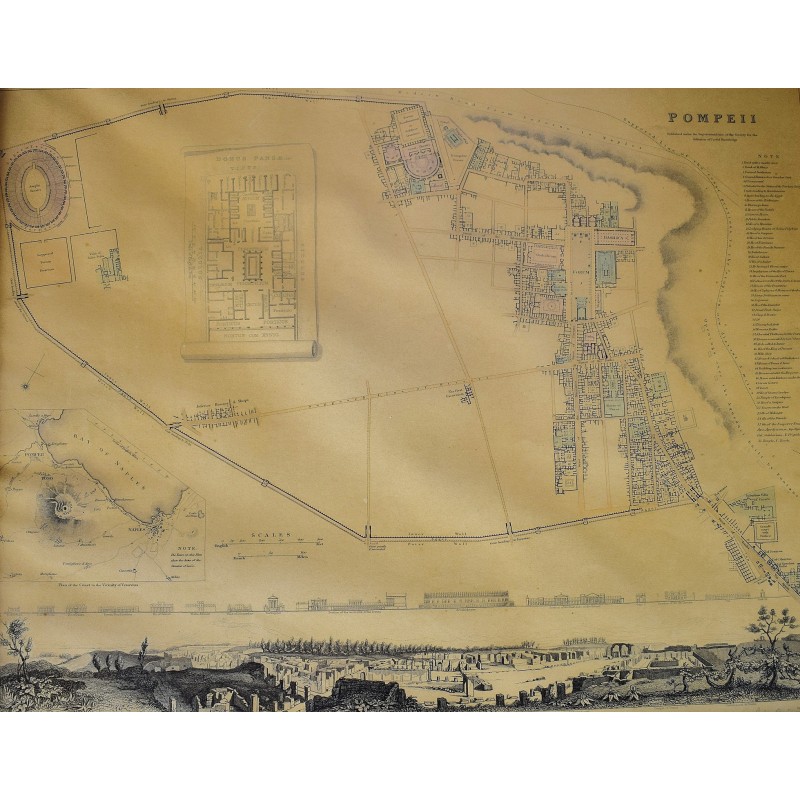
Pompeii. Published under the superintendence of the Society for the Diffusion of Useful Knowledge. Drawn by W.B. Clarke, arch. Engraved by T.E. Nicholson. Published by Baldwin & Cradock, 47 Paternoster Row, July 1, 1832. [Map framed under glass]
Society for the Diffusion of Useful Knowledge; T.E. Nicholson
London: Chapman & Hall, 1832
[Map framed under glass] 44 x 36 cm. (Dimensions in frame). Engraved map. Hand colored. Inset: Plan of the coast in the vicinity of Vesuvius. Includes panoramic view, and drawings of 14 building facades. Light toning. Phillips, 794. (May be the 1844 printing, states 1832 on map. Ref: Baldwin & Craddock, Maps of the Society for the Diffusion of Useful Knowledge. Vol. 1. London: Chapman and Hall, 186, Strand, 1844.)
This is an oversized or heavy book, which requires additional postage for international delivery outside the US.