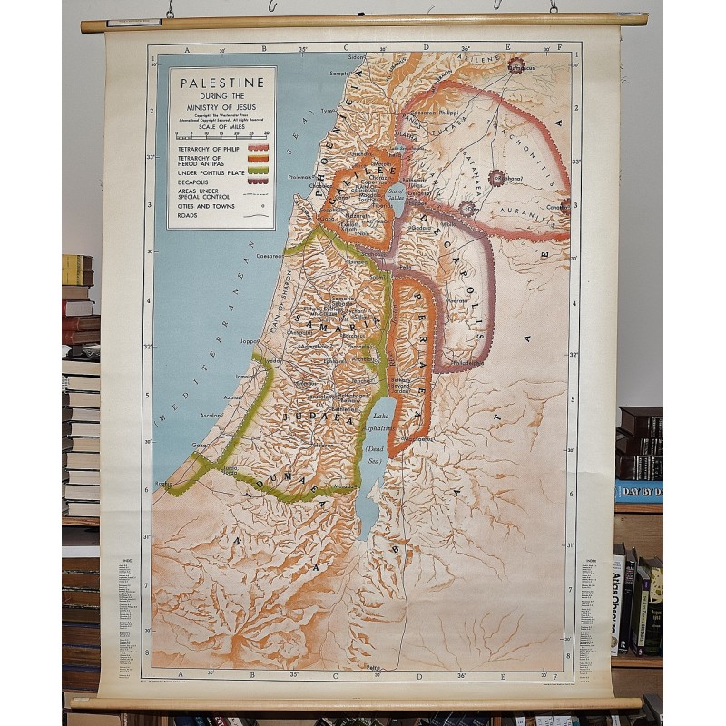
Palestine During the Ministry of Jesus (Large Pull Down Map)
Click Image for Gallery
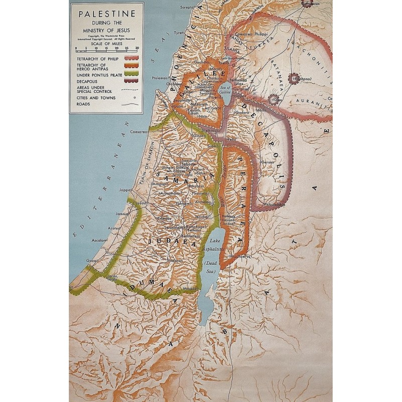
Palestine During the Ministry of Jesus (Large Pull Down Map)
G. Ernest Wright, Floyd Vivian Filson, Westminster Press
Westminster Press, 1965
142 x 108 cm. Large wall map, mounted on muslin, with wooden rods, top and bottom. Minor toning. Scale ca. 1:1,900,000. Relief shown by shading. Shows borders during the reigns of Philip, Herod Antipas, Pontius Pilate, and Decapolis; areas under special control, cities and towns, roads. "WPL 11."
Note: This is a large, heavy map. Additional postage will apply depending on delivery location.