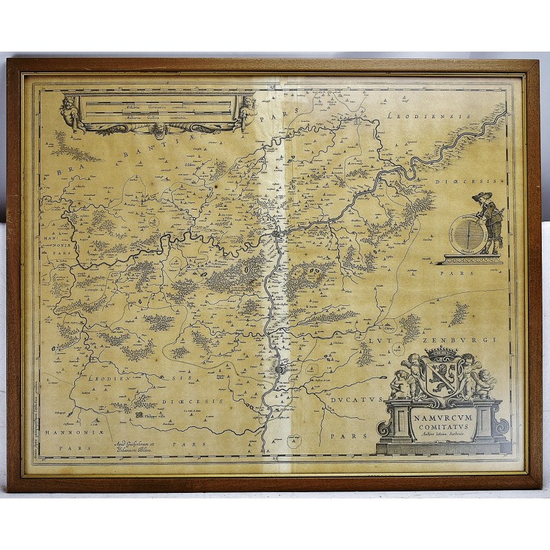
Namurcum Comitatus Auctore Iohann Surhonio [17th Century Map of Belgium]
Click Image for Gallery
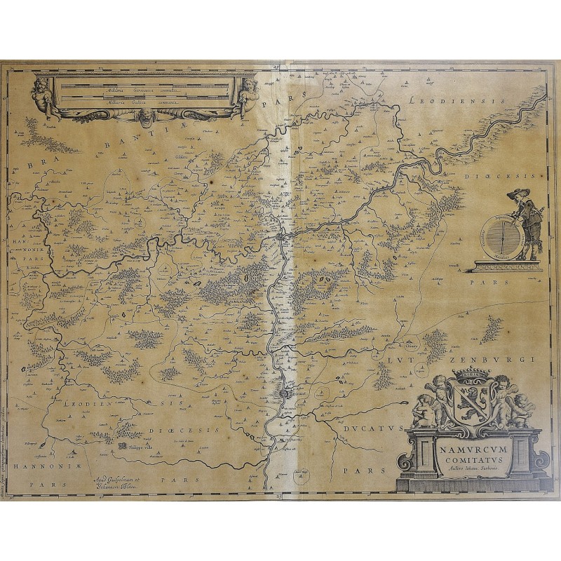
Namurcum Comitatus Auctore Iohann Surhonio [17th Century Map of Belgium]
Surhon, Jean; Jan Jansson; Johannes Janssonius
Amsterdam: J. Blaeu., 1660
[17th Century Map of Belgium] 20 1/8" x 23 3/4". (57 x 46.5 cm in frame) Map under glass in wood frame. Toned. Light crease in center. <br> Jansson (Dutch 1588-1664). Depicting the region around the city of Namur at the confluence of the Meuse and Sambre Rivers. Based on the once secret map of Jacques Surhon (ca. 1555). Copper engraved on laid paper, decorated with figurative title cartouche featuring a coat of arms and four putti, an unusual compass flanked by a surveyor, and a large scale of miles cartouche. Van der Krogt (Vol. II) #3340:2.2.
This is an oversized or heavy book, which requires additional postage for international delivery outside the US.