Map of Boston and the Country Adjacent From Actual Surveys

Click Image for Gallery
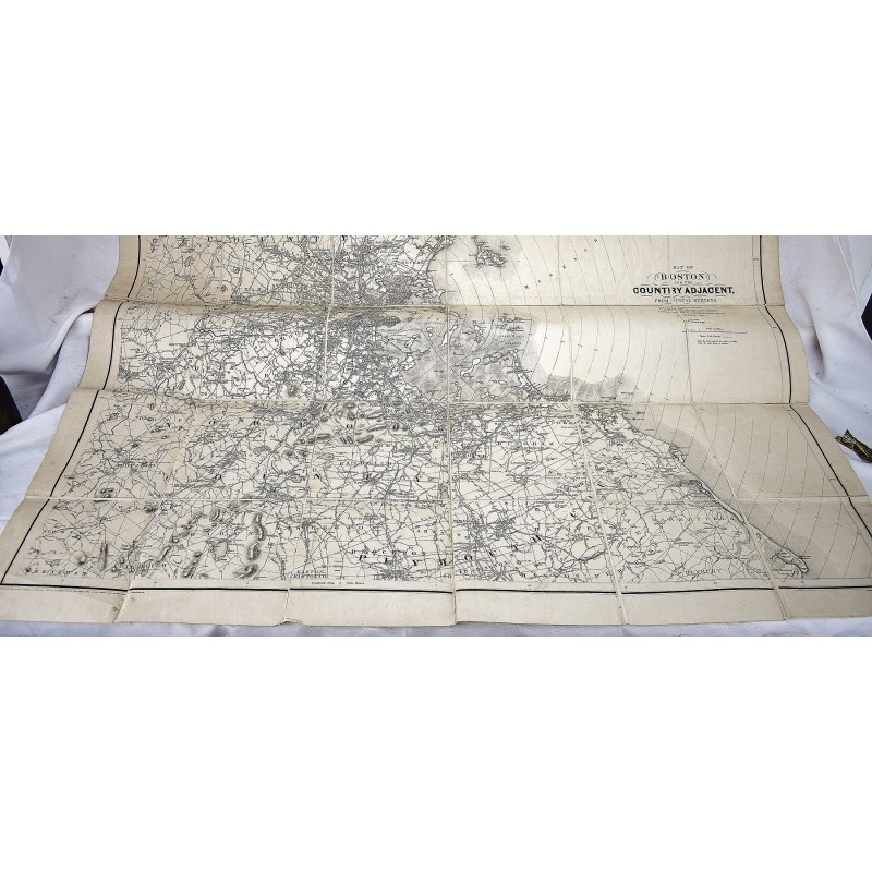
Map of Boston and the Country Adjacent From Actual Surveys
Henry Francis Walling
A. Williams & Co.; Published at the Boston Map Store, 1881
Large, sectional map of Boston and surrounding counties. 45 x 43-1/2 inches (114 x 110.5 cm). 36, linen-backed sections. Moderate shelf wear. Scale [ca. 1:64,000]. Prime meridian: Boston State House. Relief shown by hachures.Shows town boundaries, roads, railroads, horse railroads, buildings, and radial distances from Boston State House.