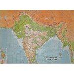
India, Pakistan, Ceylon and Burma: Physical-Political (Large Pull Down Map)
Click Image for Gallery
India, Pakistan, Ceylon and Burma: Physical-Political (Large Pull Down Map)
W. & A.K. Johnston & G.W. Bacon Ltd
Johnston and Bacon, Edinburgh, 1962
98 x 129 cm. Mounted on muslin and fitted with rods. Some creasing, general wear. Scale 1:3,000,000. Notes: Relief shown by gradient tints and spot heights; Depths shown by gradient tints; Includes inset of Ceylon. Bangladesh is not independent.
Note: This is a large, heavy map. Additional postage will apply depending on delivery location.


